Gone are the days of $5 lift tickets and paper trail maps. Practically everything you need to enjoy the slopes now fits on your cell phone.
Whether you’re preparing to pull out your pass or track your top speed, there’s an app for that. Here are the best digital companions for your next ski adventure, plus a couple to help you get there safely.
Best for mountain monitoring: EpicMix, Ikon Pass, or wherever you hold a season pass
Price: Free
Available on iOS and Google Play
Whether you’re Team Epic, Team Ikon, or have a season pass to an independently-owned mountain, do yourself a favor and download the corresponding app to wherever you’re skiing. The perks are plenty. For example, EpicMix, which caters to Epic Pass holders, lets users curate their preferred resorts into a dashboard where they can see how many lifts and trails are open, the weather forecast, ski patrol contact information and even chairlift wait times.
Similarly, the Ikon Pass app includes trail maps and information about the number of lifts and runs open, plus webcam feeds so skiers can see mountain conditions in real time. Mountains like Telluride Ski Resort and Powderhorn have their own apps with trail maps, weather details, and food and beverage guides.

Best for stats tracking: Slopes
Price: Free to $29.99/year
Available on iOS and Google Play.
When you’re looking for details about how fast and how far you’ve traveled by ski or snowboard, Slopes is there taking notes. Just hit “record” before you jump on the mountain and the app will track the time you spend on runs versus chairlifts, your speed and mileage. That data powers a map so you can retrace your day. Most of the functionality is available for free, but those looking to compete with friends can upgrade to a premium subscription ($29.99 annually) to compare stats.
Snonav, which offers users step-by-step directions down the mountain similar to Google or Apple Maps, is another option for those who are directionally challenged or trying out a new resort. And for those suffering from app fatigue, it’s worth noting Strava also records alpine skiing activity data.

Best for winter weather tracking: OpenSnow
Price: Free to $39.99/year
Available on iOS and Google Play
Whether you’re chasing powder or just trying to figure out how many layers to wear, OpenSnow is an essential tool to understanding mountain conditions. Meteorologists provide weather forecasts and analyses so users can decide which days they should try catching the first chair. Skiers can also customize their dashboard to feature stats from their preferred resorts and keep up with daily snow totals, as well as add easy-to-access trail maps to their account. While the app is available for free, most of the in-depth functionality comes at a cost: $29.99 per individual annually or $39.99 for up to four users annually.
To dive deeper into wind, weather and air quality conditions at the top of peaks nationwide, consider OpenSnow’s sister app, OpenSummit, which is an excellent resource for exploring mountaintops in the not-so-snowy months.

Best for keeping an eye on the road: CDOT Colorado Road Conditions
Price: $2.99/year
Available on iOS
Maybe you don’t need to worry as much about the road conditions when you’re in a four-wheel drive vehicle, but in the spirit of preparedness, it helps to know what’s causing traffic congestion, where the plows are out, and how slick or snowpacked the highway may be. The app CDOT leverages all that data and more from the Colorado Department of Transportation and presents it in a user-friendly fashion. Though the app is not created or managed by CDOT, it stays current with information about traffic accidents, construction and road conditions so you feel empowered setting off on your next adventure. Users can even customize CDOT camera images and live video streams for their favorite routes to get real-time looks at the highways.
In late 2021, the agency CDOT debuted its own app called COtrip Planner, which includes similar functionality with a different user interface, plus the ability to map directions to a destination. That app is free and available on both iOS and Google Play, though it has a lower rating than the unaffiliated CDOT app.

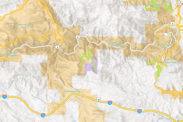
A screenshot shows trail maps within the COTREX system on June 1, 2017.
Best for local adventures of all kinds: COTrex
Price: Free
Available on iOS, Google Play and online browser
So downhill skiing isn’t your thing? No sweat. Let Colorado Trail Explorer (COTrex) be your guide to the local hotspots for nordic skiing, snowshoeing and snowmobiling. Created by the Department of Parks and Wildlife, COTrex consolidates mapping data from 230 land managers to create the most comprehensive guide to trails in the state. The interactive interface lets users search for trails by the specific sport, see trail length and copy trailhead coordinates into other mapping apps. It’s a great companion year-round, too, since it includes routes for hiking, mountain biking, OHV riding and more. It’s like AllTrails, but better because it includes trails yet to be discovered by AllTrails users and the GPS functionality works even when you don’t have cell service — for free.

